HERE's Map Creator is a publicly available tool that allows anyone to edit road information, cycle paths, places, and addresses. The changes you make in Map Creator make their way to HERE's maps and the governments, citizens, companies, and vehicles around the world that rely upon them.
Mapillary is available in Map Creator as a source for imagery and data. This help guide walks you through the map editing process using Mapillary as a data source.
- Enabling the Mapillary image overlay
- Navigating Mapillary images
- Working with automatically detected traffic signs
- Creating a Mapillary account to collect imagery yourself
Enabling the Mapillary image overlay
Access the Mapillary street-level image overlay by clicking on the Mapillary icon in the bottom right-hand concern of the map view.
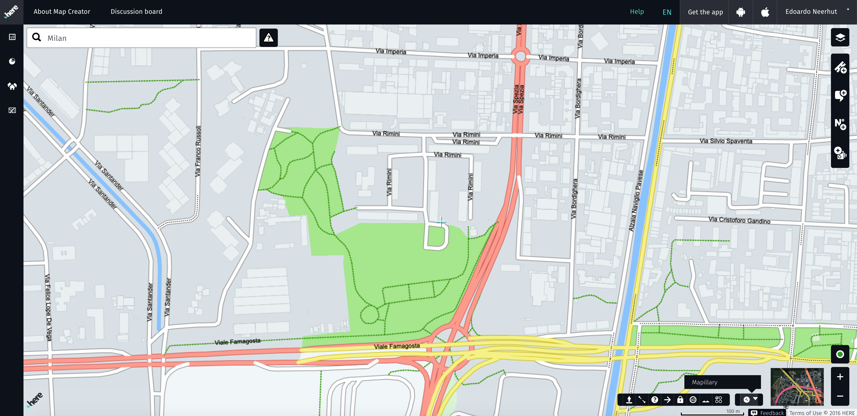
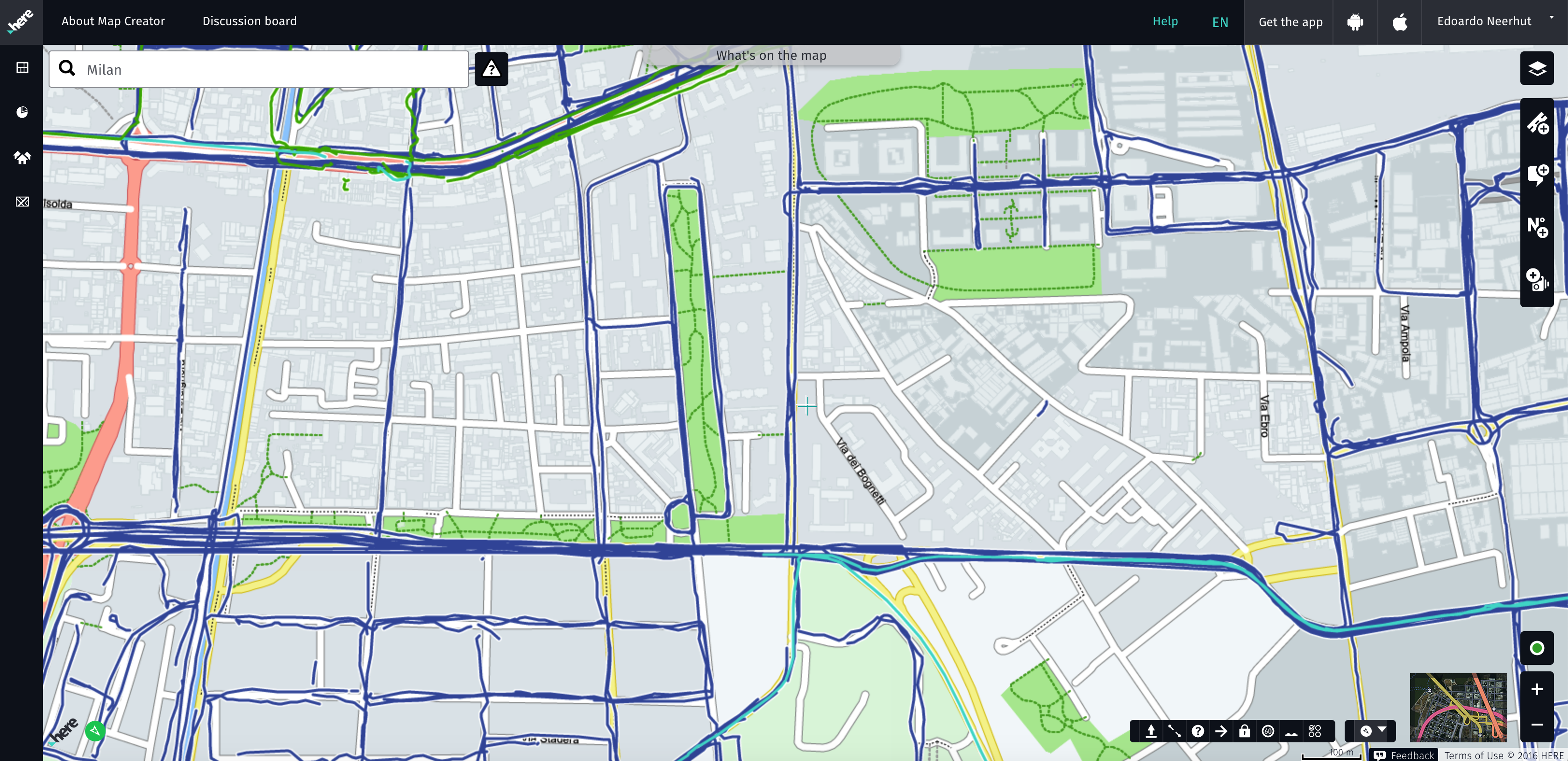
If there is imagery in the area you are viewing, it will appear on the map as colored lines, reflecting the age of the imagery.
- Green = less than 1 month
- Cyan = 1–3 months
- Navy = older than 3 months
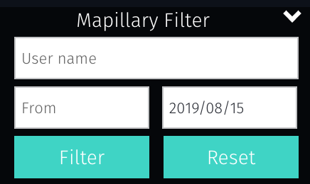
The arrow next to the Mapillary icon allows you to filter images by date range and username.
Navigating Mapillary images
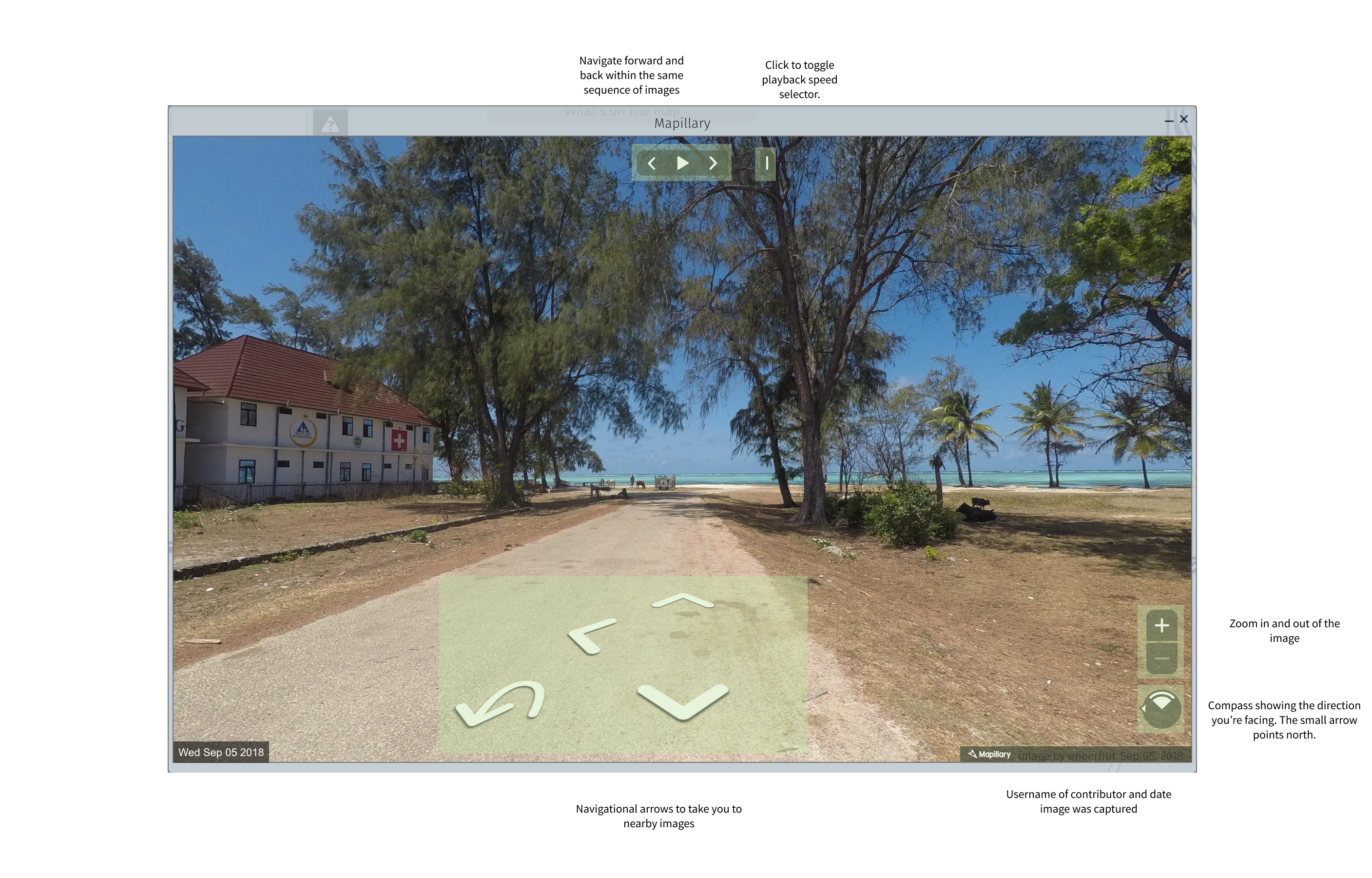
To view images in the area, click on one of the lines. This will open up the image viewer.
The image viewer allows you to navigate among sequences of imagery that you and others have captured. It can be resized by clicking and dragging the edges of the viewer.
Working with automatically detected traffic signs
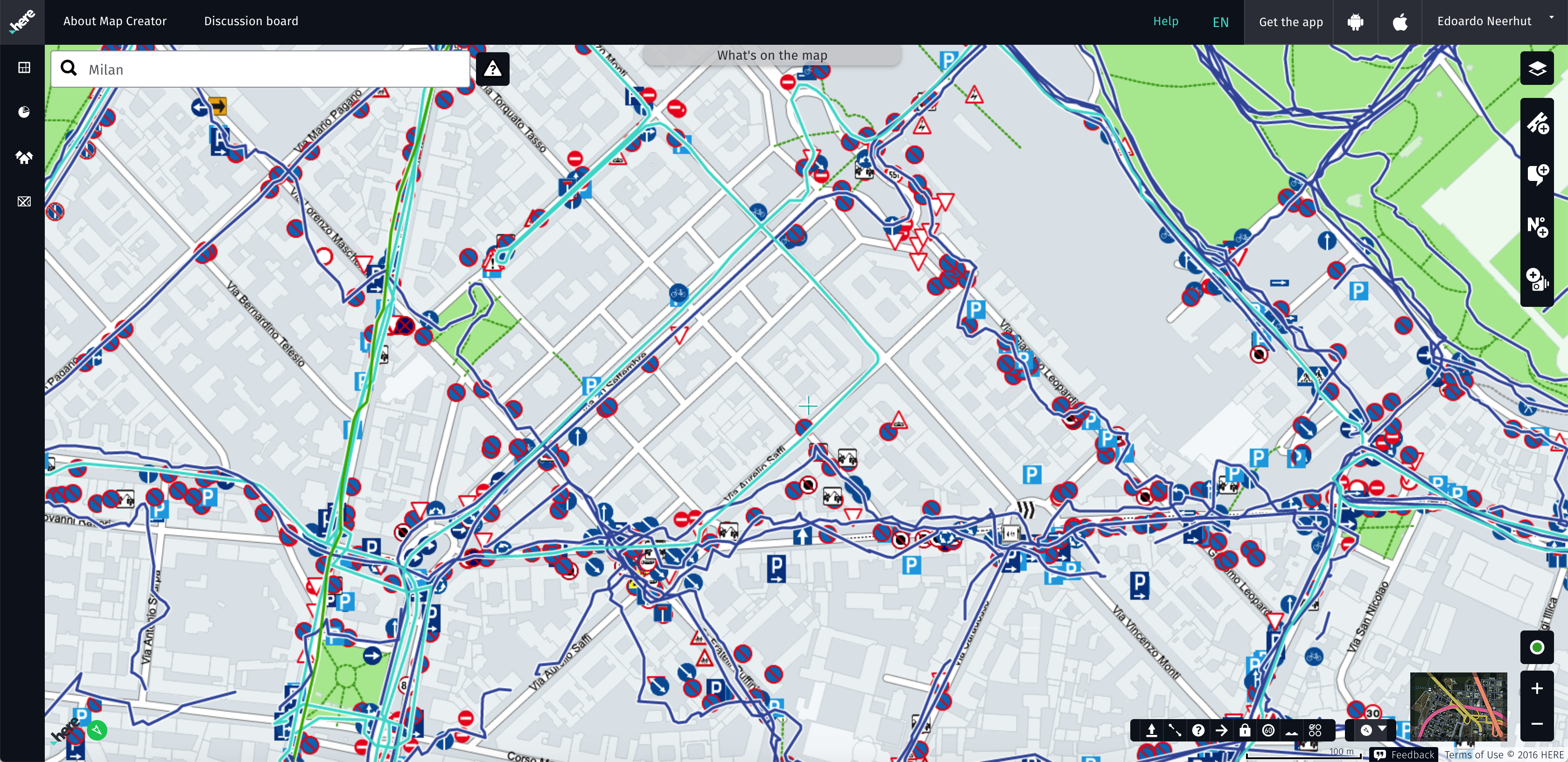
One of the most powerful uses of Mapillary is the data that Mapillary automatically extracts from images using computer vision. The thousands of traffic signs Mapillary detects are available within Map Creator by toggling the traffic sign layer.
The traffic sign layer can be activated by clicking the layer icon in the top right and then choosing Mapillary Traffic Signs under the Support Layers dropdown. If traffic signs have been detected in the area, they will populate the map as you see below.
Clicking on one of the traffic signs will bring up a window showing one of the images in which the sign was detected. You can also view other images in which the sign was detected.
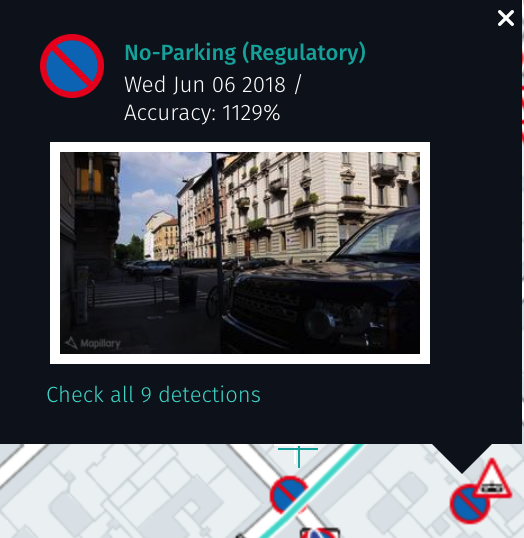
Mapillary estimates the position of the traffic sign by triangulation, using the different images that the sign was detected in.
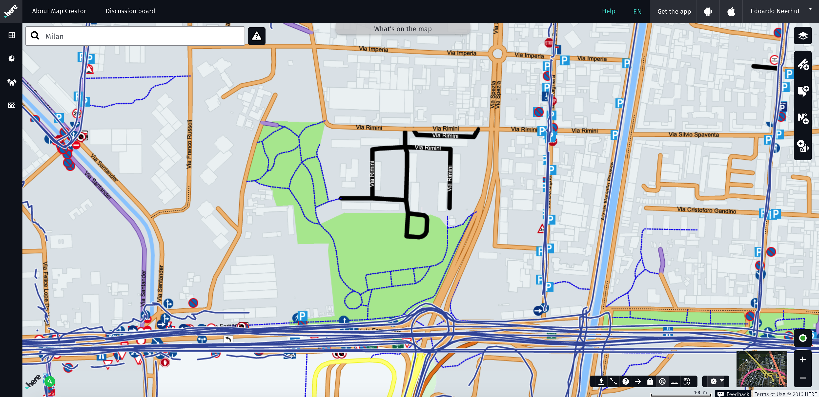
The traffic sign layer is particularly useful when adding speed limit information. In Map Creator you can highlight roads by speed limit by clicking the button resembling a 60 km/h speed sign on the bottom right of the map.
This will color-code all the roads, allowing you to quickly see the speed limit across different roads. Black indicates a road where the speed limit is unknown, so look out for these and see whether Mapillary has identified a speed limit sign in the area.
Creating a Mapillary account to collect imagery yourself
If there's no imagery available in the area you want to edit on the map, you can easily contribute it yourself. To get started, create an account on Mapillary.
- Follow this link to the sign-up page →
- Choose a Mapillary username
- Provide an email address to be used for communications (this email will not be visible to anyone publicly).

Take a look at the Contributing section of our Help Center to learn about capturing and uploading images to Mapillary.